Mapping boundary lines is an important part of responsibly managing your forest. Make sure you know about your property boundaries in Maine before you render logging services or plan for wood harvesting in the future.
William A. Day Jr. & Sons can help you connect with the right personnel in your area. This guide can also give a rough idea of woodlot property lines in Maine and how to recognize them. We have curated this guide for you to Maine forest boundary lines.
Why Do You Need To Know Property Boundaries?
Mapping boundary lines is necessary to know where your property begins or ends. This way, you can avoid disputes and stress that come with the litigation process between neighbors. Boundary mapping is also useful from an investment point of view. For instance, if you wish to sell your property, you must first know the particulars of it for appropriate listing and pricing.
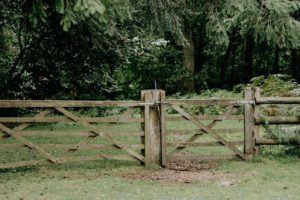 Property Line Marking in Maine
The Maine State applies technical standards to monuments. The Maine Board of Licensure’s rules for land surveyors list the following:
Placement
The licensee must ensure enough monuments on the property upon survey completion. The location of boundaries should be obvious and apparent.
Identification and Detection
The licensee must ensure that every monument is located in a way that its material, size, and composition are sufficient:
- The chance of disturbance is limited.
- Monument’s life expectancy will be over 25 years.
- The monument can be detected with devices.
- The licensee can identify the monument by inspection.
How To Find Property Boundaries?
If you’re curious about your boundary lines, follow these steps to find the lines:
Homeowner Deed
A deed includes a plat’s measurement, lot number, shape, landmarks, geographical features, block, and other identifiers. It’s a legal description of land with technical language, so you’ll need to consult relevant professionals to decipher it.
Measuring Tape
You can visually confirm your boundary lines using a tape measure. Use a known point in your deed, measure to the edge of your property, and put a stake to mark it. Once you have determined all the edges, measure the distance between each stake and compare the results to match your deed.
You can also find boundary lines on your property’s corner. Look for stakes or metal pins buried in the ground. The markers are also available on the land survey. Alternatively, you can use a shovel or metal detector to find the lines.
In the absence of these markers, you can visit Maine Forestry Services’ websites for land surveys. You and your neighbor can also agree to property boundaries in Maine through many line agreements but check your subdivision and zoning ordinances to ensure you comply.
If you already know your property line and would like to mark it, follow these steps:
- Paint the boundaries with durable, high-grade paint. You can use colors such as blue, yellow, red, or orange because these are easily visible and can be seen from a long distance. There are paints specifically available for mapping boundary lines. Alternatively, you can use oil-based paint because they last longer and are brighter. You should only paint trees if their bark is dry and warm.
- Use the following rule in painting and blazing trees:
-
- If your property line passes through the middle of your trees, paint and blaze on both sides.
- If the line passes adjacent to your trees, paint and blaze only one point.
- Ensure that you paint and blaze both sides so it can be visible from either side to prevent trespass.
- You can simply paint the trees if you don’t want to blaze them. You’ll have to use a hatchet or an ax to clear branches.
-
- Avoid using valuable trees as blaze markers unless they’re on the boundary itself. Boundary trees cannot be harvested, though “witness trees” are able to be harvested, though. Ensure that blazing is about 4-5 inches and is located 5ft above the ground.
- Clean or brush boundary lines for easy locating and traveling.
- You can also hang flags or set grade stakes to map boundary lines on your woodlot.
- Contact Maine Forestry Services if you believe someone has trespassed or cut timber on your land.
At William A. Day Jr. & Sons, we understand that the first step to an efficient and effective timber harvest is to have clear property boundaries and what it includes. If you’re looking for the right land surveyor in Maine and New Hampshire, contact us today. We’ll help you connect with the right personnel to prepare your land for the next harvest. Alternatively, you can hire us for logging, timber valuation, and selling services.